Selecting a side scan sonar system isn’t about choosing the “most powerful” unit—it’s about matching the equipment to your operational environment, survey vessel, depth range, resolution needs, and project deliverables.
If you’re new to the technology, start with our guide on what side scan sonar is and how it works.
A shallow-water debris detection scope has very different requirements than a deep-water corridor survey. The more precisely you define your mission profile, the easier it becomes to select side scan sonar equipment that delivers consistent, defensible results.
Explore our range of side scan sonar systems.
Start with the Survey Objective: What Do You Need to Detect?
Most side scan sonar procurement decisions become clearer when you answer:
- Are we mapping seabed texture and sediment transitions?
- Are we detecting targets (debris, boulders, UXO indicators)?
- Are we supporting route engineering for pipeline/cable?
- Do we need inspection-level detail or corridor-level coverage?
Your objective drives frequency selection, range settings, towfish choice, and processing expectations.
Side Scan Sonar Frequency vs Range
This tradeoff is explained in detail in our side scan sonar frequency and resolution guide.
| Factor | High Frequency | Low Frequency |
|---|---|---|
| Resolution | Higher (clear small objects) | Lower |
| Range / Swath | Shorter | Longer |
| Best Use | Detailed inspection, small targets | Corridor surveys, large area coverage |
| Typical Depth Use | Shallow to mid-water | Mid to deep water |
| Survey Goal | Accuracy and detail | Efficiency and coverage |
Instead of thinking “high frequency is best,” think “best for what the client must sign off.”
Shallow Water vs Deep Water Requirements
Shallow Water
Typical needs:
- higher resolution for debris and hazards
- stable towing close to seabed
- careful altitude control for consistent imaging
Deep Water
Typical needs:
- reliable performance at depth
- efficiency and large corridor coverage
- robust tow cable and handling requirements
- stable data return with longer ranges
“Deep water side scan sonar” decisions often include deployment logistics and tow stability as much as sensor performance.
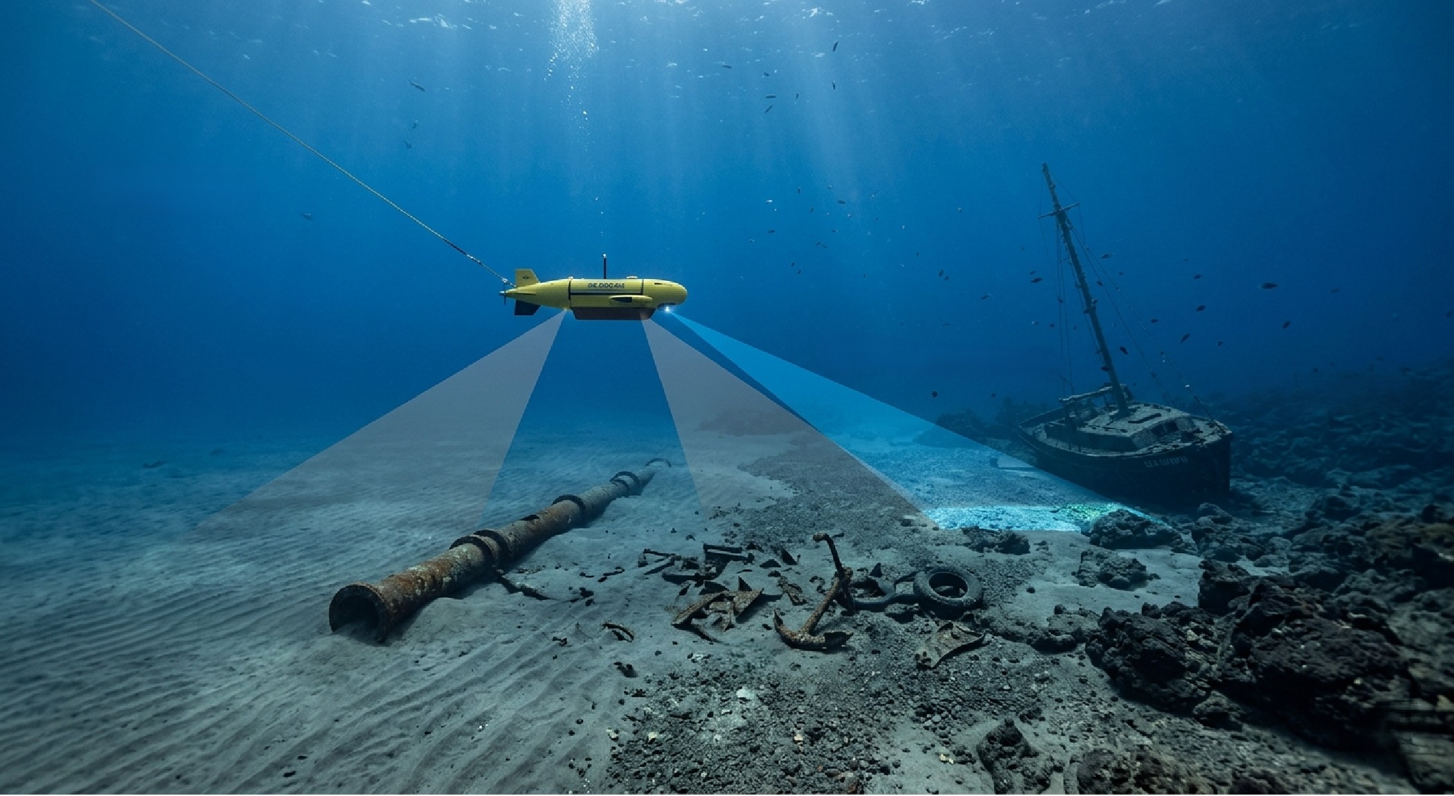
Towfish Side Scan Sonar: Why Configuration Matters
A towfish configuration affects:
- imaging stability
- altitude control
- cable requirements
- ease of deployment
Ask these practical questions:
- What tow speed is typical for our vessel?
- How consistent is our seabed altitude control?
- Are we operating in areas with strong currents?
- What handling systems are available onboard?
In many offshore cases, towfish side scan sonar is preferred because it keeps the sonar at a controlled altitude and distance from seabed features, improving image consistency.
Vessel and Mobilization Constraints
Even the best sonar won’t deliver if it’s poorly integrated with vessel operations. Consider:
- available deck space and handling systems
- winch and cable capacity
- power requirements
- integration with navigation and positioning systems
- operator workflow and training requirements
A “perfect” sonar that delays mobilization or complicates operations can become expensive quickly.
Data Quality Factors That Affect Your Results
Even with strong equipment, data quality depends on:
- tow altitude and consistency
- seabed type (soft mud vs rocky terrain)
- speed stability and line planning
- environmental noise and vessel motion
- processing and interpretation workflow
When comparing side scan sonar solutions, it’s worth evaluating not just the hardware spec sheet, but how the system supports consistent field results.
Processing, Mosaics, and Deliverables
If your project requires mosaics, target lists, and interpreted results, confirm:
- supported processing workflow
- compatibility with your survey processing environment
- how easily you can build mosaics and classify targets
- reporting and deliverable format expectations
For corridor projects, the value often comes from how quickly teams can turn raw imagery into actionable engineering insight.
Recommended Selection Checklist (Practical)
Use this checklist before committing to a system:
- Required target size (small debris vs large hazards)
- Depth range and environment (shallow vs deep)
- Required coverage speed (wide swath vs detailed passes)
- Towfish handling capacity onboard
- Navigation and positioning integration
- Deliverables and reporting requirements
- Operator experience and processing capability
How to Choose the Right Side Scan Sonar System
The right side scan sonar system depends on your survey objective, required resolution, water depth, and operational constraints. High-frequency systems are typically used for detailed inspection and small target detection, while lower-frequency systems are preferred for wide-area coverage and corridor mapping. In most offshore projects, the best approach is to match system configuration to deliverables rather than selecting based on specifications alone.
Side Scan Sonar Systems for Offshore Projects
Side scan sonar systems are available in multiple configurations depending on project requirements, including shallow water inspection, deep-water corridor surveys, and geophysical mapping. Selecting the right system often involves balancing performance, deployment logistics, and data processing workflows.
Choosing the right side scan sonar system means aligning equipment performance with survey outcomes, not just technical specifications. When the right sonar is matched to the mission, you get clearer imagery, fewer re-runs, more confidence in hazard detection, and stronger deliverables.
Explore our range of side scan sonar systems for offshore and geophysical surveys.


")


