Why Offshore Survey & Construction Projects Use LBL
Offshore survey and construction projects — including field development, pipelines, wind farms, UXO clearance and decommissioning — all depend on knowing the precise position of subsea assets.
Long Baseline (LBL) acoustic positioning uses a network of seabed transponders to create a stable subsea reference frame, allowing ROVs, AUVs and survey sensors to calculate highly accurate positions underwater.
Because the reference network is fixed on the seabed rather than the vessel, LBL delivers stable and repeatable positioning, particularly valuable for deep-water survey, subsea construction and high-precision metrology operations.
While USBL systems are often used for rapid deployment surveys, LBL becomes the preferred solution where accuracy, stability and repeatability are critical.
Key Takeaways
- Long Baseline (LBL) positioning uses seabed-mounted transponders to create a stable underwater reference frame for survey and construction operations.
- Because the reference network is fixed on the seabed, LBL positioning remains stable regardless of vessel motion or water depth.
- LBL systems are widely used for offshore survey, subsea construction, pipeline installation, metrology and DP reference operations.
- LBL arrays are typically deployed using seabed transponders, ROV or AUV transceivers, and integrated navigation software combining INS, DVL and acoustic ranges.
- Compared with surface-referenced systems such as USBL, LBL offers higher stability and repeatability for long-duration offshore projects.
Typical LBL Architecture for Offshore Survey Spreads
A typical offshore LBL spread designed for survey and construction work includes:
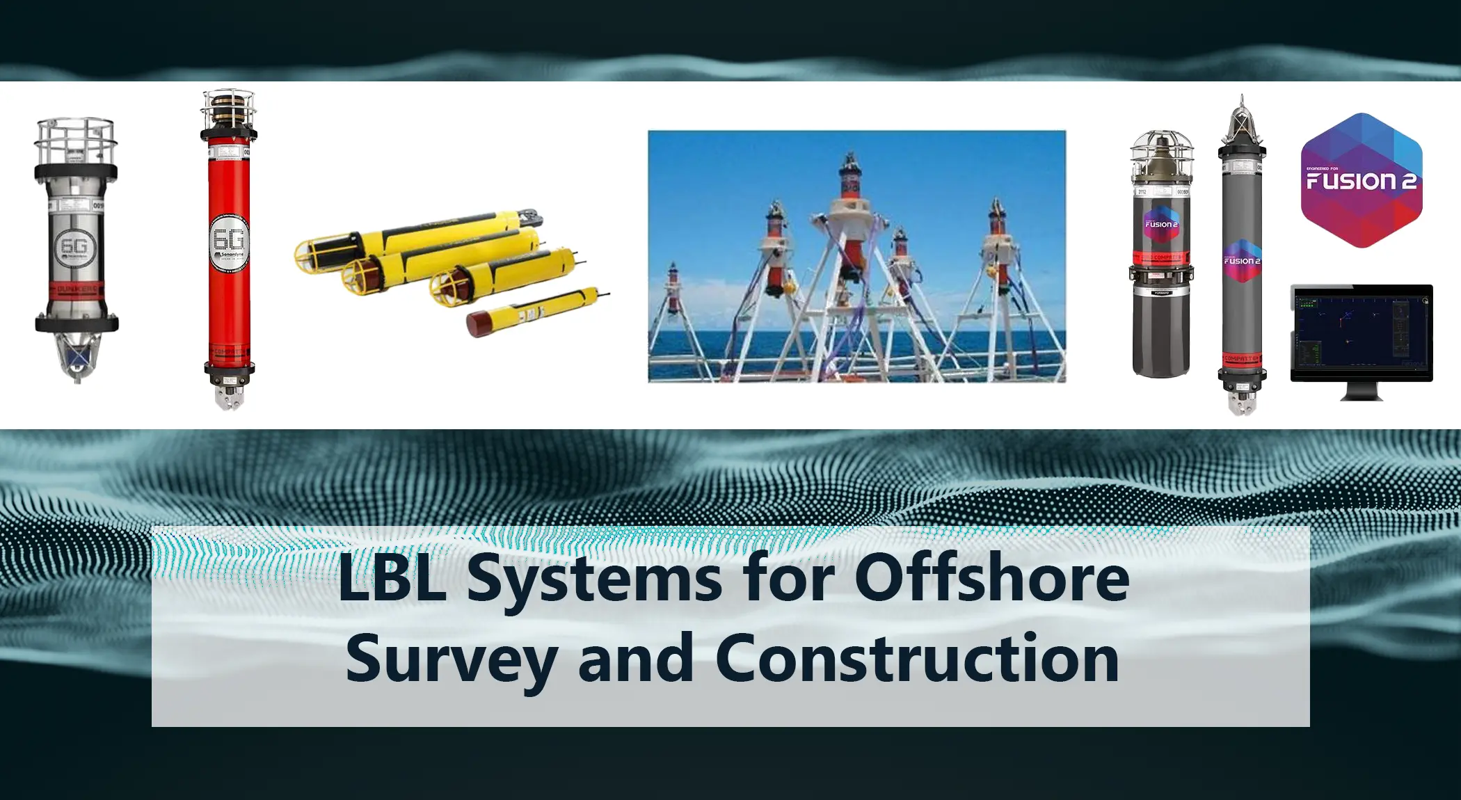
Seabed Transponder Array
Transponders (e.g. Sonardyne Compatt 6/6+, Midi Compatt 6) deployed around the worksite or along a pipeline route.
Baseline lengths in the order of 50–2,000 m provide strong geometry for position solutions over large areas.
ROV or AUV-Mounted Transceiver
Devices such as Sonardyne ROVNav 6 mounted on work-class ROVs handle LBL ranging and telemetry back to the vessel.
Vessel Dunker or Hull Transceiver
Over-the-side deployed systems like Sonardyne Dunker 6 provide LBL and telemetry capability without major hull modifications.
Navigation & Fusion Software
Platforms such as Sonardyne Fusion 2 fuse GNSS, INS, DVL, USBL and LBL ranges into a consistent multi-sensor navigation solution, simplifying complex field developments.
All of these building blocks sit under Unique Group’s Long Baseline Systems (LBLs) category, alongside related tools such as INS, DVL and USBL equipment for hybrid configurations.
How LBL Fits Into Offshore Survey Workflows
1. Pre-Lay Route and Site Surveys
Before a pipeline, cable or structure is installed, survey teams require high-quality baseline mapping of the seabed.
An LBL network is deployed around the planned route or site.
ROVs or AUVs run pre-lay survey lines while navigating on LBL combined with INS and DVL.
The combination of LBL positioning with multibeam, side-scan sonar and sub-bottom profiling produces precise georeferenced data to support engineering decisions.
2. Structure Installation and Metrology
For jacket, template, manifold or suction pile installation, survey teams must know exactly where each structure sits relative to design coordinates and neighbouring assets.
LBL supports this by:
- Providing an absolute reference frame on the seabed.
- Allowing ROVs to perform spoolpiece and jumper metrology, where very small mis-closures can make the difference between an easy tie-in and a costly re-work.
- Delivering repeatable positions for as-built surveys and future inspection campaigns.
Products such as Sonardyne Fusion 6G LBL Acoustic Positioning Systems and Gyro Compatt 6+ are designed to support this type of high-accuracy construction work, combining LBL ranges with inertial sensors for fast, stable solutions.
3. Pipeline and Cable Installation
For pipelines and power or export cables, contractors need to monitor:
- Touchdown point of the pipeline or cable
- Lateral and vertical departure from design route
- Interaction with seabed features or existing infrastructure
An LBL array laid along the route, combined with ROV-based tracking and INS, provides highly accurate touchdown monitoring and as-laid data — particularly useful in deeper water or in areas where USBL performance may be affected by multipath or acoustic noise.
4. Using LBL as a DP Reference in Offshore Fields
Dynamic positioning (DP) vessels often use a mix of:
- GNSS
- Gyro and motion reference units
- USBL (surface-referenced)
- LBL as a subsea reference
By tying DP to an LBL network on the seabed, operators gain a stable subsea reference that is less sensitive to GNSS outages or multipath, particularly in congested offshore fields or near large structures.
LBL for UXO Clearance and Decommissioning
As offshore renewable projects and decommissioning work expand, UXO (unexploded ordnance) clearance has become a major application for subsea positioning.
LBL systems offer:
- Reliable tracking of ROVs and AUVs scanning the seabed for UXO.
- Accurate relocation of identified objects for neutralisation or removal.
- A stable geodetic frame to merge geophysical data, UXO targets and engineering constraints.
Unique Group can supply the key LBL components typically used in UXO clearance spreads, including seabed transponders, vehicle transceivers and integrated navigation software.
Choosing and Configuring an LBL System
For any given project, the right LBL configuration depends on:
- Water depth and area coverage
- Required accuracy and repeatability
- Duration of operations (short campaign vs multi-year field)
- Available vessel time and spread costs
- Interaction with other sensors (INS, DVL, USBL, GNSS, DP)
A practical starting point is to:
- Define the operational box and required accuracy.
- Design an LBL array (number of beacons, spacing, water depth).
- Decide on the mix of Compatt transponders, ROVNav or Dunker transceivers and LBL + INS software required.
For a more conceptual overview of how LBL works, see our introductory guide: What Is LBL?


")


