Processors for Geophysical Survey Equipment from Unique Group
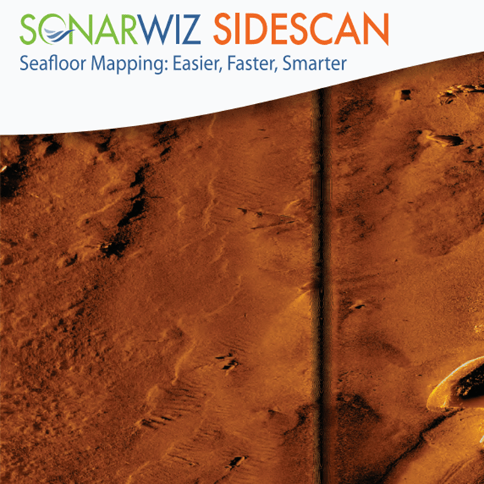
The Processors category on Unique Group’s website features the Chesapeake SonarWiz: Processing Software Dongle, an advanced software designed to streamline the geophysical survey process. The software simplifies the number of programs required for processing survey data, as it works with most sonar manufacturers, eliminating the need to learn new software for different equipment.
The processor for geophysical surveys boasts several features that enhance the surveying process, including the ability to interface with all commercially available side-scan sonar, sub-bottom profilers, magnetometers, echo sounders, and bathymetric interferometers. It also offers automated survey line planning and polygon-based survey line placement, saving time and increasing efficiency. Additionally, the Chesapeake SonarWiz: Processing Software Dongle allows for previewing files with the SNIFF feature and adding and fixing navigation data with NavInjectorPro.
SonarWiz’s Layout Manager is another impressive feature that helps users to position windows and menus efficiently and save frequently used layouts. The software can generate planned survey maps as a GeoTIFF, GeoPDF, JPEG, ECW, or Google Earth, making it easy to share and visualise survey data.
Need to know more about why our processors are the best for Geophysical surveys?
- Exceptional compatibility: The software is compatible with a wide range of sonar hardware from leading manufacturers, including C-MAX, Atlas NA, Imagenex, Innomar, EdgeTech, Falmouth Scientific, Klein Marine Systems, Jetasonic, Kongsberg Hugin AUV, GeoAcoustics, Knudsen, Marine Sonic, Kongsberg Mesotech, R2Sonic, SyQwest, PingDSP, Teledyne Gavia, Teledyne Benthos, Tritech, and Teledyne Odom.
- Extensive applications: Our processors can be used for various tasks, such as identifying silt, creating crisp sonar mosaics with any map projection, dealing with high-resolution data compatibility, and displaying waterfalls and contact zooms. A flexible software solution for geophysical surveying, Dual-Channel Bottom Tracker may be utilised with Independent Dual-Channel ROVs and offers both manual and automatic modes.
- Competitive price point: Our processor’s geophysical survey price is reasonable.
Want the advanced features of our geophysical surveying processors to provide accurate results and increase the efficiency of your mapping/survey operations? Contact us now!