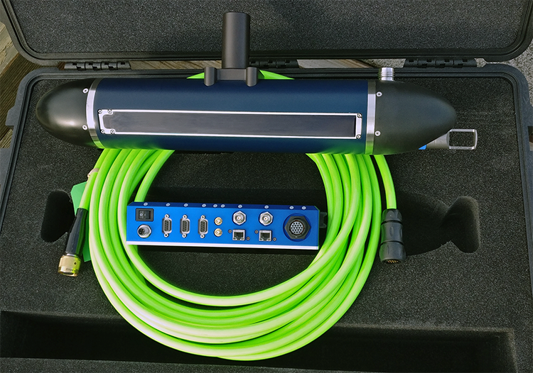
Ping 3DSS iDX450 PRO Bathymetric Sonar
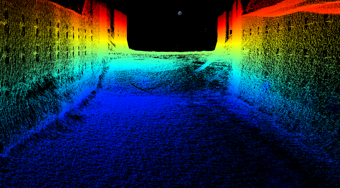
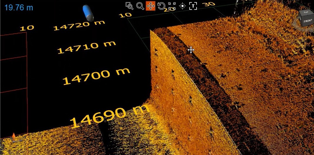
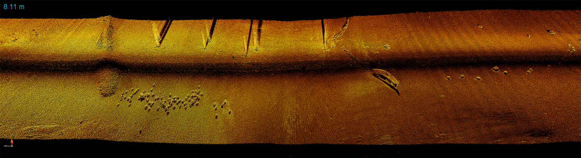
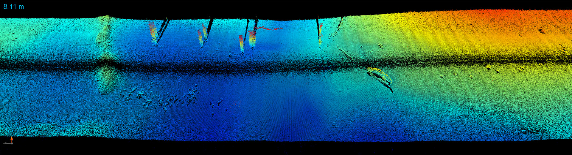
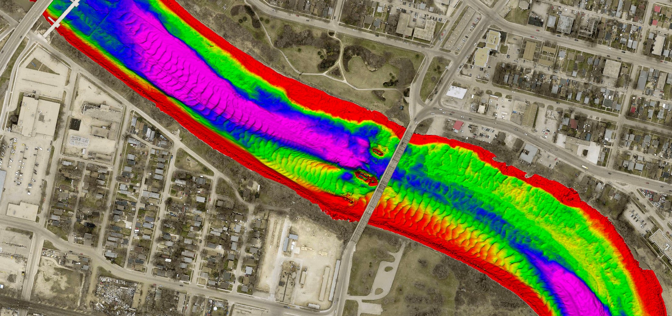
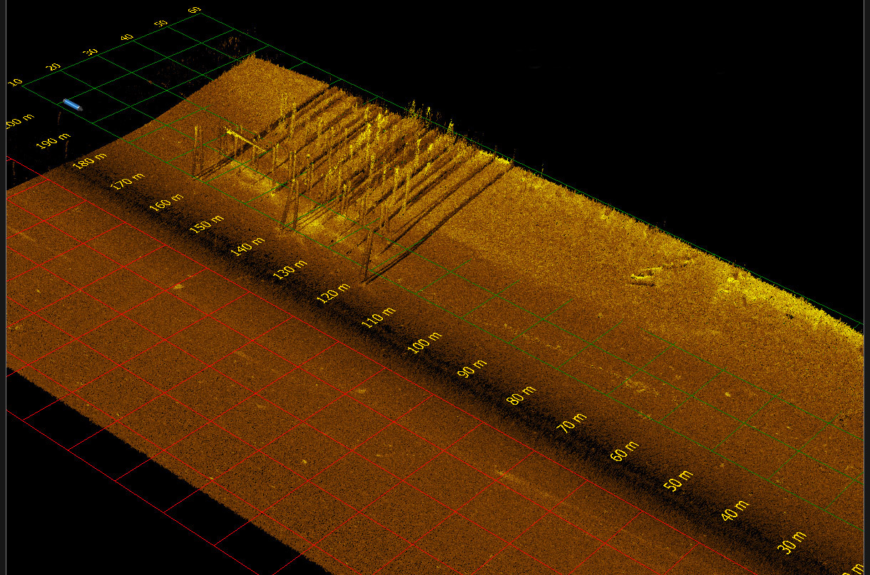
The 3DSS sonar employs patented Computed Angle-of-Arrival Transient Imaging technology (CAATI) to provide high accuracy, wide swath echo sounding together with co-registered geometrically correct high resolution 3D and 2D imagery.
3DSS technology supplements multibeam echo sounders (MBES) in shallow water by providing wider coverage together with 3D imagery. 3DSS technology also supercedes interferometric phase based sonars by separating seabed returns from sea surface, water column and multipath interference to provide clean and accurate bathymetry together with stunning 3D and 2D imagery.
For shallow water hydrography, the 3DSS Sonar is simply the best and most versatile mapping and imaging sonar available.
Features
Accurate, high resolution, ultra-wide swath echo-sounding and 3D/2D imagery, with integrated real-time surface sound velocity, high accuracy INS position / attitude and optional RTK, PPK, PPP provide the best available hydrographic survey and imaging performance in shallow water. 3DSS-iDX incorporates a patented signal processing methodology that extends the single angle-of-arrival principle used in interferometric systems to accommodate multiple simultaneous backscatter arrivals (e.g. the seabed, sea surface, water-column, and multipath). The result is superior wide swath bathymetry and true 3D sidescan imaging and from a compact, easy-to-use sonar. At the heart of the 3DSS-iDX sonar is Ping DSP’s state-of-the-art SoftSonar TM electronics technology with ultra-low noise, wide dynamic range receivers, state-of-the-art acoustic transducer arrays, Gigabit Ethernet, easy-to-use software interface, and integrated support for a wide range of third party survey software and hardware.
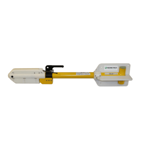
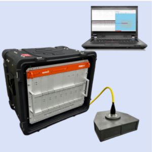
The iDX-450 Pro integrates SVT and a SBG Ekinox high-performance and versatile inertial navigation solution into the sonar head for turnkey operation. A Universal Sonar Interface Unit provides ultra-portable, easy operation with just a laptop and a battery or easy interface to external MRU, GNSS and INS systems on a fully equipped survey launch or ASV.
Specifications
- Frequencies: 450 kHz
- Transmit Waveforms: CW, Broadband
- 3D Imaging Swath Width 8-14 times sonar altitude
- Max bathymetry range 120m per side
- Sounding accuracy exceeds IHO Special Order.
- Max sounding depth 75m (but reduced swath width
- Multibeam Equivilant Mode settings : Beamwidth (0.25°-5°), Sector (90°-220°), Beams (3-1024), Mode (Equidistant, Equiangle, Hybrid)
Applications
- Shallow Water Hydrographic Surveys
- Low Logistics Hydrographic Surveys
- Habitat Mapping
- Shallow Water IED Mine-hunting (MCM) Detection
- Port & Harbor Security
- Marine Debris Search
- Subsea structure surveying / inspection
- Dredging Operations
- Underwater archaeology
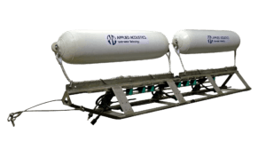
- ASV and AUV applications
- Tailings Pond Surveys