Survey Equipment
GNSS Equipment, Navigation + Data Acquisition, Surface Vessel Equipment, Survey EquipmentTrimble CenterPoint® RTX
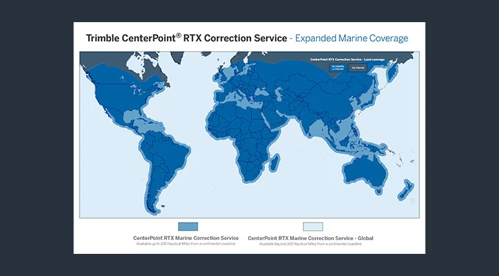
Trimble RTX® service complements your RTK solutions and delivers 2 centimeter accuracy for your most precise survey work. Globally available via satellite or cellular delivery, Trimble RTX correction service empowers users with the freedom and mobility to work without the constraints of a base station or VRS network, even in the most remote locations or most challenging environments.
Availability:
Sale
Trimble RTX® service complements your RTK solutions and delivers 2 centimeter accuracy for your most precise survey work. Globally available via satellite or cellular delivery, Trimble RTX correction service empowers users with the freedom and mobility to work without the constraints of a base station or VRS network, even in the most remote locations or most challenging environments.
Features
The following Trimble Centrepoint ® RTX subscriptions are available from Unique.
Marine Global CenterPoint RTX : Duration – 1 Month; 3 Months; 1 Year
Marine Regional CenterPoint RTX (within 200 km): Duration – 1 Month; 3 Month; 1 Year
Marine Coastal CenterPoint RTX (within 20 km): Duration – 1 Month; 1 Year
Specifications
| Availability |
|---|
CenterPoint RTX correction service is delivered via geo-stationery L-band satellites in real-time. The signal is received at the GNSS rover by the Trimble GNSS Antenna or GNSS Smart Antenna, so there is no need for a UHF radio or cellular network connection.
Applications
Hydrographic survey
Seafloor mapping
Harbour mapping
Product Enquiry