Coastal erosion—driven by rising sea levels and climate change—demands accurate, real-time data to safeguard coastlines and infrastructure. Modern survey equipment for coastal erosion management, including echosounders, LiDAR, ADCPs, and RTK GNSS systems, provides the foundation for effective monitoring and long-term shoreline protection. By integrating these datasets into GIS and predictive models, coastal engineers can plan adaptive, data-driven interventions. Unique Group delivers advanced survey technologies and expertise that empower authorities to enhance coastal resilience worldwide.
Key Takeaways
- Survey equipment is critical for monitoring and mitigating coastal erosion, supporting decisions on shoreline restoration, sediment transport, and infrastructure resilience.
- Tools like multibeam sonar, LiDAR, RTK GNSS, and ADCPs provide accurate bathymetric, elevation, and hydrodynamic data essential for erosion risk assessment and intervention planning.
- Survey data feeds into GIS and modelling systems, enabling real-time hazard mapping, scenario planning for climate change, and performance validation of coastal defences.
- Both soft (nourishment, dune restoration) and hard (groynes, seawalls) engineering methods depend on accurate geospatial data for design, implementation, and monitoring.
- Unique Group provides end-to-end coastal survey solutions—from equipment to training—helping authorities in vulnerable regions implement proactive, sustainable erosion management strategies.
Introduction
Accelerated by rising sea levels, climate change, and rapid coastal development, the natural process of coastal erosion is reshaping coastlines, degrading natural habitats, and threatening critical infrastructure across coastal areas.
As coastal environments face increasing pressure from wave energy, storm surges, and shoreline retreat, the consequences are severe: ecological value is lost, existing coastal defences are compromised, and coastal towns are left vulnerable to further erosion.
Addressing this global issue starts with one important element, which is access to real-time data for managing coastal erosion. Survey equipment provides the eyes and ears that enable coastal managers to detect subtle changes, understand sediment behaviour, and plan proactive interventions.
Why Survey Data Is Foundational to Coastal Erosion Management
Managing coastal erosion begins with understanding how natural coastal processes operate and evolve. With the right survey tools in place, coastal engineers and planners can:
- Detect shoreline retreat, shifting sand dunes, and beach profile changes
- Track longshore sediment transport, active sediment cells, and coastal wave energy dispersion.
- Measure beach profile changes, quantify sediment displacement, and track the rate of shoreline material loss over time.
These insights feed into predictive environmental models and support integrated coastal management strategies, including:
- Hazard mapping and zoning of erosion-prone coastal regions
- Adaptive planning under climate change and sea level rise scenarios
- Real-time risk mitigation via early warning systems
At their core, survey tools underpin both soft and hard engineering approaches, ensuring coastal erosion strategies are implemented and adjusted when needed.
Essential Survey Equipment for Coastal Erosion Management
Survey equipment supports every stage of coastal erosion management, from pre-assessment and design to monitoring and post-intervention evaluation. Here are the technologies that play a role in this:
1. Multibeam and Single Beam Echosounders
These tools deliver high-resolution bathymetric surveys of coastal areas, helping to visualise the seabed and track sediment transport.
Especially useful for monitoring underwater terrain mapping in active erosion zones or near sloping structures, they are essential for understanding how wave action alters seabed profiles over time.
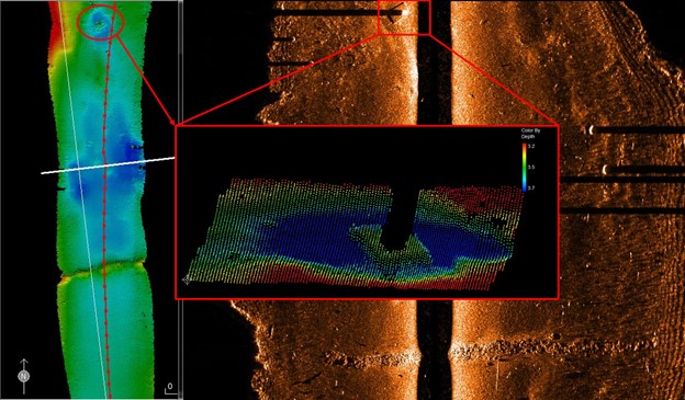
2. Side Scan Sonar & Sub-bottom Profilers
Side Scan Sonars image the sub-surface beneath coastal structures and assess buried erosion risks beneath sea walls, breakwaters, or groynes.
Sub-bottom profilers support foundation stability assessments and uncover hidden geotechnical threats post-storm events, aiding the evaluation of coastal protection works.
3. Subsea Laser Scanners (LiDAR)
LiDAR platforms produce high-resolution 3D point clouds of submerged terrain and shoreline gradients, essential for identifying scour zones and coastal squeeze near engineered structures.
These tools play a major role in detecting weak points in coastal defences and informing strategic plans for dune restoration.
4. Wave & Tide Gauges, Acoustic Doppler Current Profilers (ADCPs)
By capturing wave energy, tidal movement, and current velocities, these sensors inform the positioning of coastal defences and help assess how structures absorb or reflect wave energy.
They also provide critical input to early warning systems for storm events and storm surges.
5. RTK GNSS Systems
Precision is everything in coastal erosion challenges. RTK GNSS ensures sub-centimetre accuracy for vessel positioning, ensuring all survey data is georeferenced.
This is vital for long-term shoreline management plans, sediment modelling, and tracking of managed realignment zones.
Integrating Survey Data into Coastal Erosion Management Strategies
Collecting data is only part of the solution. Integration into layered systems like GIS empowers coastal managers to take informed action. Here’s how:
- GIS integration enables layered visualisation of erosion risks, sediment movement, and coastal protection measures
- Simulation tools enable coastal planners to model future scenarios, including sea level rise, climate variability, and progressive shoreline erosion.
- Shoreline management plans become living documents, updated with real-time inputs to guide intervention
This data-driven approach underlines Integrated Coastal Zone Management (ICZM), balancing ecological preservation with economic development in coastal communities.
Moreover, repeated surveys help verify whether soft engineering strategies, such as sand nourishment, or hard engineering, like rock armour, are actually reducing risk or merely displacing it.
Coastal Erosion Management Techniques That Depend on Accurate Surveying
Every intervention, whether soft or hard, depends on trustworthy survey inputs:
Soft Engineering Techniques
- Beach nourishment, sand management, and dune rehabilitation require elevation tracking, dune vegetation monitoring, and sediment flow modelling to effectively reduce coastal erosion.
- Habitats like salt marshes and mangrove forests must be tracked for growth, erosion resistance, and ecological health
- These natural buffers offer coastal protection and contribute to environmental conservation
Hard Engineering Techniques
- Structures like sea walls, revetments, groynes, and breakwaters rely on accurate seabed surveys and predictive wave modelling.
- Monitoring how they alter wave direction, resist storm waves, and interact with beach material is critical for ensuring durability
- Designs can be re-validated or modified through feedback loops from LiDAR, sonar, and tide gauges
Without accurate data from the equipment outlined earlier, both approaches risk failure, leading to further erosion, budget overruns, or loss of natural habitats.
Unique Group’s Survey Solutions: Supporting Coastal Resilience Worldwide
Renowned for its subsea technologies, Unique Group is a go-to partner for coastal erosion projects in both the Middle East and developing coastal regions.
Our survey portfolio for coastal protection works includes:
- Multibeam and Single Beam Echosounders for bathymetric profiling
- RTK GNSS Systems for high-precision mapping in dynamic coastal environments
- LiDAR platforms for dune and slope modelling
- Side Scan Sonar & Sub-bottom Profilers for detecting buried risks beneath coastal defences
- Wave and Tide Gauges, ADCPs, and supporting systems for dynamic current monitoring
Applications Include:
- Harbour and shoreline protection
- Coastal development planning
- Marine spatial planning
- Shoreline restoration and erosion, and flooding mitigation
Unique Group also offers tailored technical support, remote integration services, and hands-on training. This helps coastal authorities build long-term resilience in the face of global threats like climate change and rising sea levels.
Final Thoughts
As coastal erosion accelerates worldwide, investing in the right survey technology today can save millions in damage tomorrow.
These instruments provide insights into shoreline dynamics, support data-led engineering decisions, and empower stakeholders to implement timely, location-specific erosion control measures.
For coastal cities and towns looking to protect their future, the message is clear: early intervention, guided by high-resolution data, is non-negotiable.
Speak with our experts to design your coastal monitoring program.
Frequently Asked Questions
How frequently should surveys be conducted in erosion-prone areas?
At a minimum, annually, though biannual or post-storm assessments are ideal in dynamic zones.
Can survey equipment be deployed in shallow water or dynamic surf zones?
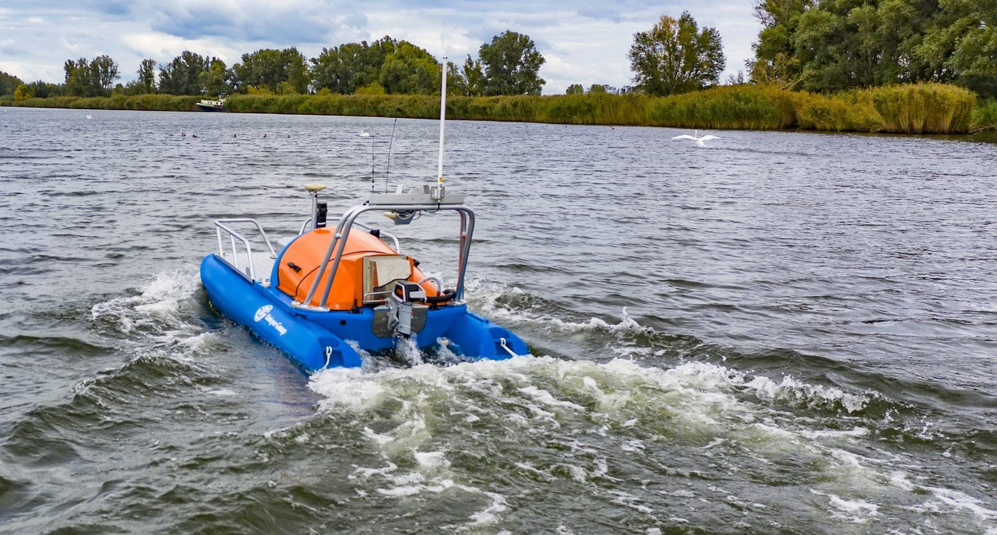
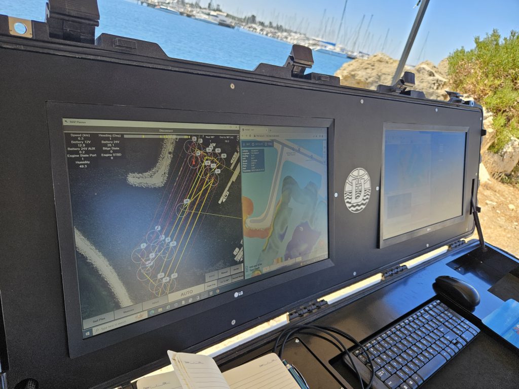
Yes. With the right platform, e.g., shallow-draft vessels or Unmanned Surface Vessels (USVs) and tool configuration, accurate data can still be collected.
What’s the best tool to monitor beach nourishment effectiveness?
A combination of LiDAR for dune and elevation mapping and RTK GNSS for repeatable shoreline positioning works best.
How is USV data integrated with bathymetric surveys?
Drone-captured orthophotos and DSMs can be layered over bathymetric grids in GIS for seamless terrain-to-seabed analysis.
Which survey method is best for monitoring beach profile changes over time?
RTK GNSS transects and cross-shore LiDAR scans provide reliable long-term datasets to track erosion patterns and dune migration.
What’s the role of LiDAR vs. photogrammetry in coastal erosion mapping?
LiDAR offers superior elevation accuracy in vegetated or complex terrain, while photogrammetry is cost-effective for general orthomapping.