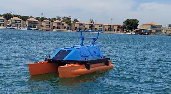
Uni-Max Unmanned Surface Vessel (USV)
The Uni-Max Hybrid Unmanned Surface Vessel (USV) is a long-endurance autonomous survey platform designed for hydrographic, geophysical, environmental, and offshore inspection operations.
• Hybrid power system for extended mission endurance up to 96 hours
• Autonomous and remote-controlled operation for efficient offshore surveys
• Compatible with a wide range of hydrographic and geophysical survey sensors
Speak with our survey specialists to discuss your project requirements.
Available for rental and sale worldwide.

The Uni-Max Hybrid Unmanned Surface Vessel (USV) is a long-endurance autonomous survey platform designed for hydrographic, geophysical, environmental, and offshore inspection operations.
• Hybrid power system for extended mission endurance up to 96 hours
• Autonomous and remote-controlled operation for efficient offshore surveys
• Compatible with a wide range of hydrographic and geophysical survey sensors
Speak with our survey specialists to discuss your project requirements.
Features
Hybrid power system integrating diesel generator and Li-Ion batteries
Autonomous, transit, anchor and mission operating modes
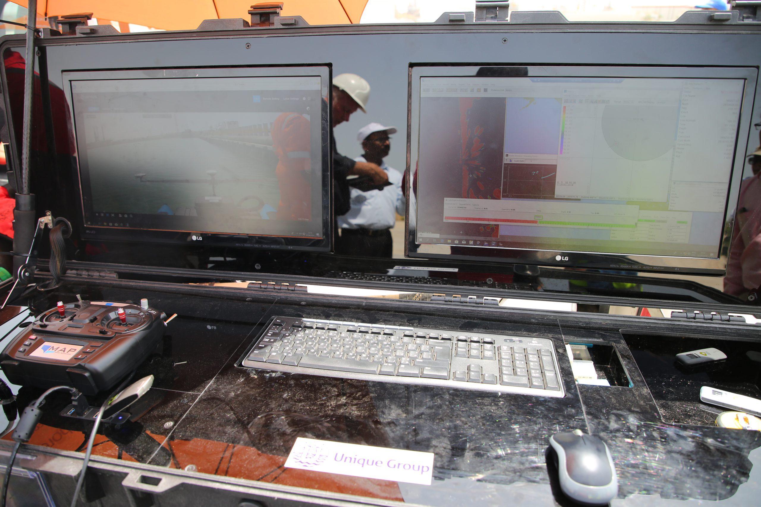
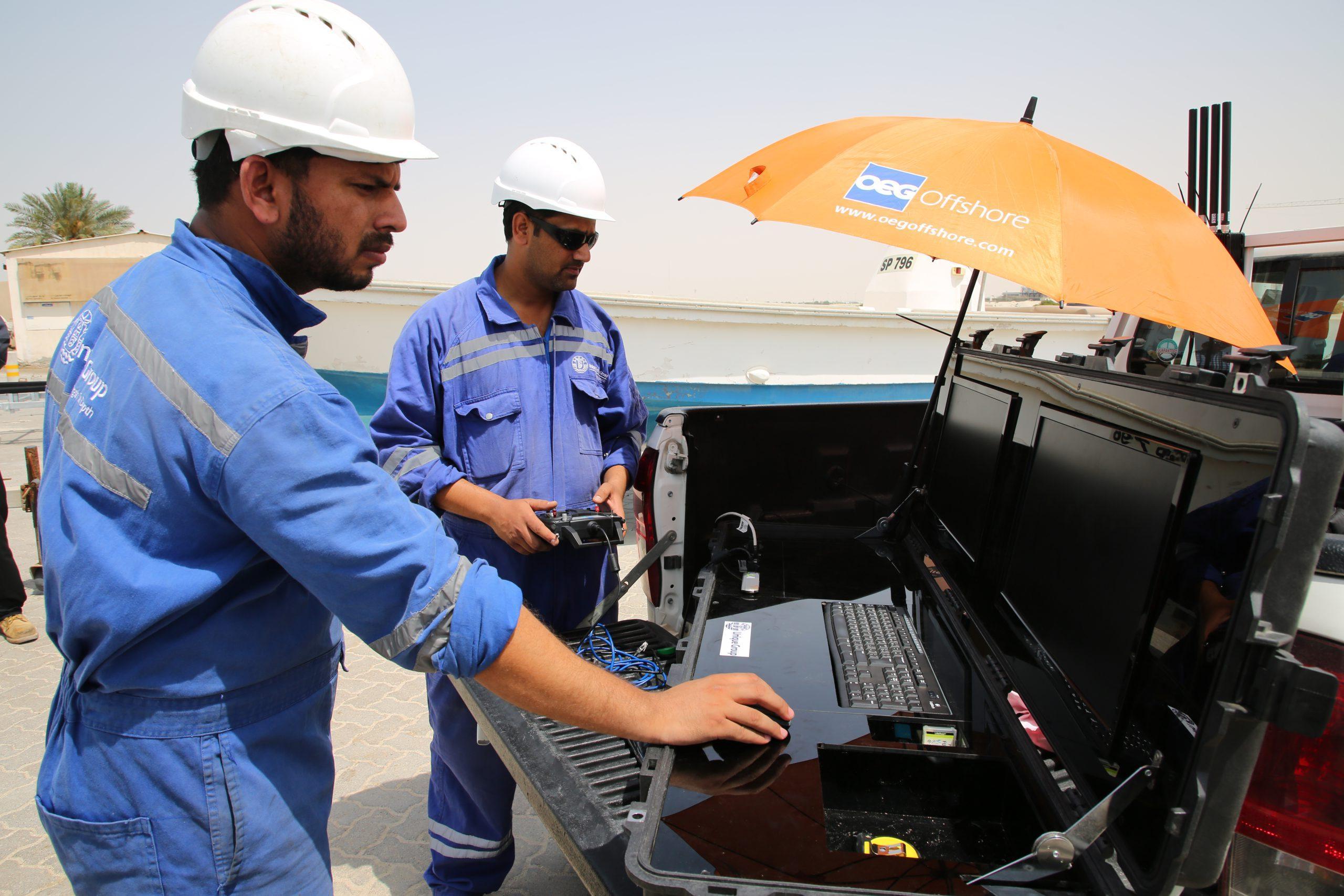
Front video camera for remote situational awareness
Radar-based situational awareness system
IP67 handheld remote controller included
Integrated navigation lighting system
Hypack-compatible survey acquisition system
Autopilot mission planning software included
Survey electronics for equipment control and integration
Compatible with major industry-standard survey sensors
Specifications
| Availability |
|---|
Length: 5m
Beam: 2.2m
Weight: 1200kg (without payload)
Endurance: Up to 96 hours (payload dependent)
Steering: Hydraulic Remote Steering
Propulsion: 2 × Torqeedo Cruise 6.0RS
Power System: Diesel Generator + 2 × Li-Ion Batteries
Speed: 4–5 knots
Autopilot: DACS Autopilot System
Data Telemetry: 4G and Uni-Mesh Radio
Refer to datasheet for detailed technical specifications
Applications
Hydrographic survey operations
Geophysical survey missions
Environmental monitoring surveys
Coastal and inland waterway mapping
Offshore inspection and asset monitoring
Autonomous data acquisition projects
Remote and long-endurance survey operations