Chesapeake SonarWiz: Processing Software Dongle
Chesapeake’s SonarWiz processing software streamlines the survey process and simplifies the number of software programs you need to learn. It operates with almost all sonar manufacturers so you won’t need to re-familiarise yourself with a different software each time you need to use different equipment.

Chesapeake’s SonarWiz processing software streamlines the survey process and simplifies the number of software programs you need to learn. It operates with almost all sonar manufacturers so you won’t need to re-familiarise yourself with a different software each time you need to use different equipment.
Features
It interfaces with all brands of commercially available sidescan sonar, sub-bottom profilers, magnetometers, echosounders and bathymetric interferometers.
Automatically plan survey lines parallel to a reference line, within a polygon based on either efficiency or conventional patterns.
Preview files with the SNIFF feature, also add and fix navigation data with NavInjectorPro.
Leverage the SonarWiz Layout Manager to position windows and menus for maximum efficiency; save frequently used layouts.
Generate planned survey maps as a GeoPDF, GeoTIFF, ECW, JPEG or Google Earth.
Specifications
| Availability |
|---|
SonarWiz is compatible with the following sonar hardware: Atlas NA, C-MAX, EdgeTech, Falmouth Scientific, GeoAcoustics, Imagenex, Innomar, Jetasonic, Klein Marine Systems, Knudsen, Kongsberg Hugin AUV, Kongsberg Mesotech, Marine Sonic, PingDSP, R2Sonic, SyQwest, Teledyne Benthos, Teledyne Gavia, Teledyne Odom, and Tritech.
Build database queries on 30+ automatic and user-defined data elds.
Dongle and dongle-free licensing (DFL) options available.
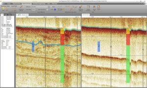
The Seabed Characterization Tool can segment acoustic imagery into homogeneous regions for sediment classification.
Applications
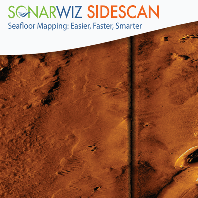
Produce high fidelity sonar mosaics with any map projection.
Work with High Resolution Data Compatibility for crisp mosaics, contact zooms and waterfall displays.
Classify sediment (seabed).
Use along with Independent Dual-Channel ROVs.
Leverage Dual Channel Bottom Tracker with manual and automatic modes.