Underwater exploration has always captivated the human imagination, unraveling the mysteries of the deep and uncovering hidden treasures. However, the success of underwater surveys heavily relies on the utilization of reliable survey equipment. Exploring the vast depths of the ocean requires specialized underwater survey equipment to gather precise data. This equipment allows researchers, scientists, and explorers to gather accurate data, study marine environments, and make important discoveries.

Ensuring Accuracy and Reliability
Underwater conditions can be harsh and unforgiving, making it imperative to have survey equipment that is robust, durable, and capable of delivering accurate results. Underwater survey equipment ensures precise and high-quality data collection. This data forms the foundation for scientific research and analysis, enabling researchers to understand and document underwater ecosystems, geological formations, and archaeological sites. Accurate data helps in making informed decisions and drawing reliable conclusions.
By collecting data on water temperature, salinity, currents, and pollution levels, researchers can assess the health of marine environments, track changes over time, and identify potential threats. This information is vital for effective conservation and management of underwater resources.
Advanced Technologies in Survey Equipment
Underwater survey equipment is constantly evolving. Data processing is now very powerful, and this coupled with the improved performance of the latest survey sensors provides today’s surveyor with very productive and efficient tools. We are seeing a great deal of development in the following areas:
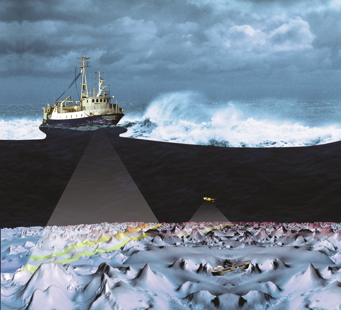
- Multibeam Sonar Systems: They are advanced acoustic imaging technologies that provide high-resolution and three-dimensional mapping of the seafloor. Multibeam sonar systems enable efficient and rapid seafloor coverage, allowing researchers to obtain detailed and accurate bathymetric maps. The latest systems are capable of steering the acoustic beams to correct vessel roll, pitch and yaw.
- Imaging: Camera technology is also providing improved data sets through greater use of photogrammetry and improved optical processing techniques allowing better imaging in turbid and low light conditions.
- Inertial Navigation systems: Systems such as Ultra Short Baseline Positioning Systems (USBL’s) and multibeam’s are often now supplied with built in high specification inertial sensors (such as Applanix POS MV), and this reduces errors that occur when data is referenced to a central survey INS located elsewhere on the vessel.
- Autonomous Underwater Vehicles (AUVs): AUVs are pre-programmed with a mission plan and equipped with sensors, navigation systems, and high-resolution imaging devices. AUVs can collect data over large areas. They are especially useful in conducting long-duration missions and accessing remote or hazardous underwater locations.

The Role of Survey Equipment Suppliers and Manufacturers
Survey equipment suppliers and manufacturers are at the forefront of developing innovative technologies and solutions for underwater surveys. They invest in research and development to design equipment that can withstand the harsh underwater conditions, operate at great depths, and deliver reliable and accurate results. These companies continuously improve their products, incorporating advancements in sensor technology, data processing capabilities, and connectivity.
Survey equipment manufacturers and suppliers work closely with customers to understand their unique requirements and provide customized solutions. They offer a range of equipment options, including sensors, ROVs, AUVs, USV’s and software, allowing customers to choose the most suitable tools for their specific survey needs.

Challenges Faced by Underwater Surveyors
Underwater surveyors face several challenges in their work, primarily due to the unique nature of the underwater environment. They must contend with unpredictable environmental conditions, including strong currents, tides, and weather changes. These factors can affect the stability of the survey vessel, impact data collection, and pose risks to personnel and equipment.
Accurate positioning is key, and it is often underestimated how difficult it is to provide accurate positioning at depth. Terrestrial Surveyors performing the same tasks on land, have access to optical instruments and high accuracy GNSS systems that can provide instantaneous results. Acoustic technology is the key hydrographic surveying technology used to provide accurate subsea positioning. The hydrographic surveyor relies on positioning ranges and bearings derived from pulses of sound travelling at about 1500m/sec, and sound does not necessarily travel in a straight line. Varying temperature, pressure, and salinity throughout the seas ensures that the transmitted acoustic pulses refract, reflect and decay. Data needs to be strictly quality controlled and processed to provide the final geolocated data.
With the latest multibeam systems providing over 2000 simultaneous beams across a wide arc, digital processing and the most accurate ancillary sensors are required. Sound velocity profilers, inertial navigation systems, and satellite positioning and timing data, all need to be well integrated and of the highest quality to ensure repeatable results.
Surveyors need to understand the differences in technology and be able to select the equipment that best suits the demands of the project.
Solutions and Services for Effective Surveying
Reliable survey equipment plays a crucial role in overcoming the challenges faced by underwater surveyors and ensuring the safety of researchers and scientists. The latest technology, when correctly integrated and used, can provide the end client with all they require for the success of their project Specially designed subsea equipment, including sensors, underwater vehicles, and enclosures, are built to withstand extreme environmental conditions. Remotely operated vehicles (ROVs), Unmanned Surface Vessel (USV’s) and Autonomous Underwater Vehicles (AUVs) are equipped with advanced navigation systems, sensors, and imaging technologies. They can operate independently or be controlled remotely from an operations center located anywhere globally. Remote sensing technology reduces the risk to scientists and surveyors when surveying in challenging environmental conditions.

Conclusion
Unique Group’s commitment to enhancing compliance and safety in offshore operations through the production of class-approved survey equipment is a significant step forward. By prioritizing safety, quality, and compliance, Unique Group establishes itself as a trusted partner for survey equipment worldwide. Our dedication to providing state-of-the-art solutions and industry-leading expertise ensures that we meet the demands of an ever-evolving industry. With our focus on safety and commitment to upholding the highest standards, Unique Group continues to play a pivotal role in advancing the field of underwater exploration and maintaining the well-being of divers and researchers. If you would like to discuss your survey requirements do contact our expert team here.


")


