Choosing between a single beam and a multibeam echosounder often starts with one question: does your survey need depth measurements along defined lines, or detailed bathymetric coverage across the seabed? Get that wrong and you either pay for coverage you didn’t need, or hand over data that falls short of the survey specification your client set.
Key takeaways
- Single beam measures depth at one point beneath the vessel; multibeam measures depth across a wide swath in a single pass.
- The right choice depends on the survey deliverable, not which system is “better.” Depth along defined lines suits single beam; full-area bathymetric coverage typically needs multibeam.
- IHO S-44 requirements for feature search and bathymetric coverage vary by survey order, so multibeam isn’t automatically required just because a survey is being run to an IHO order.
- Both single beam and multibeam systems are available for short-term hire as well as purchase.
What’s the difference between single beam and multibeam echosounders?
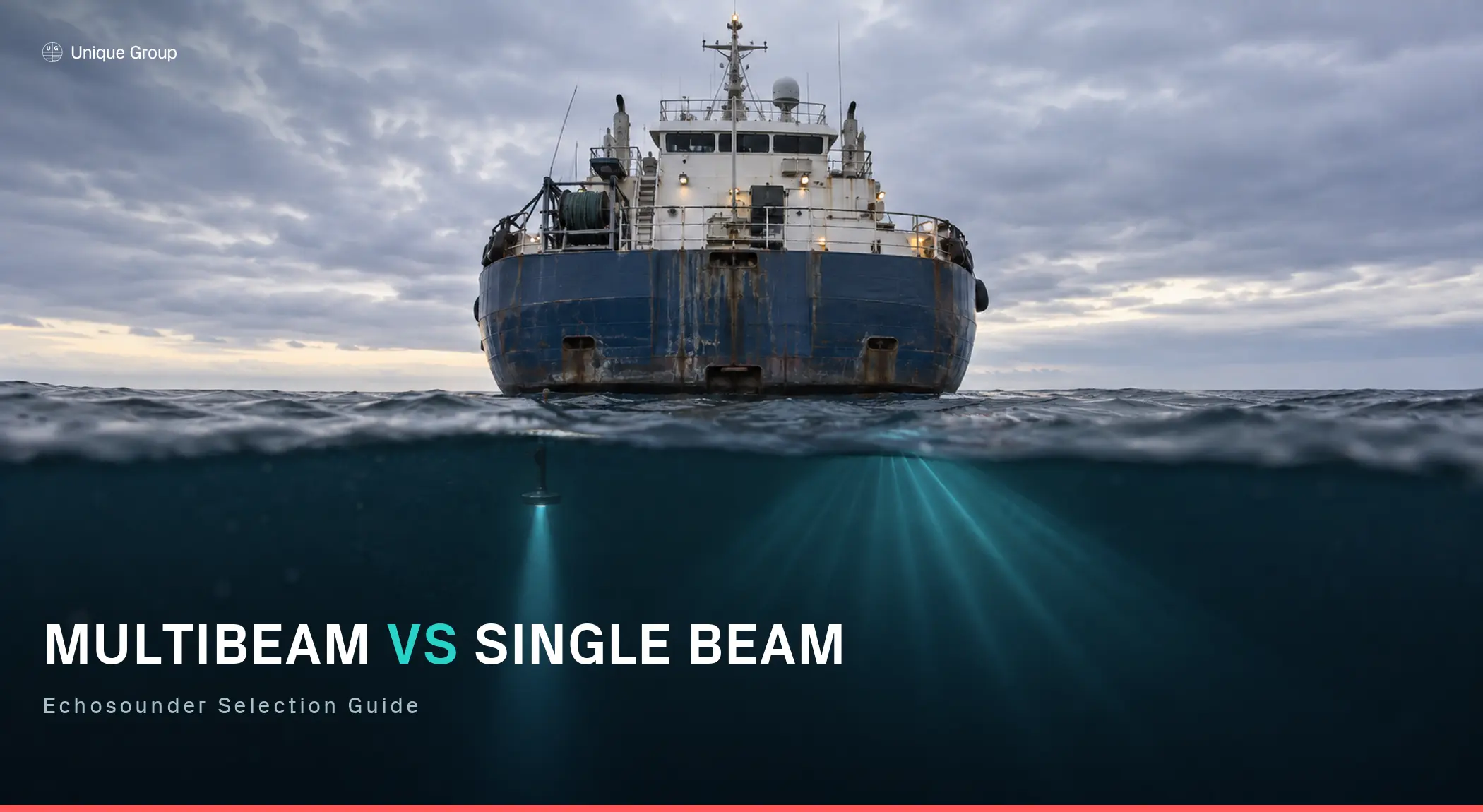
A single beam echosounder measures water depth at one point directly beneath the vessel, building a line of depth readings as the vessel moves. A multibeam echosounder measures depth across a wide swath at once, producing many depth measurements across each swath rather than a single measurement beneath the transducer.
Both rely on the same underlying principle, timing a sound pulse’s round trip to the seabed and back, but they answer different questions. Single beam tells you the depth along a line. Multibeam tells you the shape of the seabed.
For a broader look at MBES types and applications, see our guide, Understanding Multibeam Echosounders and Their Applications.
How each system actually works
A single beam system sends one acoustic pulse straight down and times the return. It’s simple, low-cost, and easy to interpret, producing one line of data per survey pass.
A multibeam system transmits a fan-shaped acoustic pulse across the vessel’s track and uses beamforming on reception to resolve returns from multiple directions across that swath. Combined with positioning, vessel-motion and sound-velocity measurements, these returns are converted into a dense set of depth measurements across the seabed in a single pass, rather than just the point below the hull.
| Survey Requirement | Typical Choice | Why |
|---|---|---|
| Depth checks along a defined line (channel, berth approach) | Single beam | Full coverage isn’t the goal, since depth measurements along defined lines or at specified locations are sufficient |
| Dredge monitoring / progress surveys | Either, depending on deliverable | Repeat profile lines and spot depths can suit single beam; full-surface coverage and detailed volume calculations typically favour multibeam |
| Small vessel or USV with limited payload/power | Often single beam | Simpler and typically lighter, though compact all-in-one multibeam systems such as the MS400C are increasingly available for small USVs and survey vessels. If you’re comparing specific MBES models, see our Multibeam Echosounder Comparison. |
| Surveys requiring extensive bathymetric coverage and/or feature search to the applicable IHO S-44 survey order | Typically multibeam | Multibeam can efficiently provide dense bathymetric coverage, subject to the complete survey system meeting the applicable uncertainty, coverage and feature-detection requirements |
| Pipeline or cable route surveys | Multibeam, often alongside other geophysical sensors | Provides detailed bathymetry across the corridor and helps identify seabed morphology and exposed features |
| Seabed object detection | Multibeam / complementary sonar systems | Dense coverage helps identify exposed seabed features and obstructions; the required sensor suite depends on target type and survey specification |
| Environmental or habitat mapping | Often multibeam | Provides detailed seabed morphology and, where suitable backscatter data are collected, information that can support seabed characterisation |
When single beam is the better choice
Multibeam isn’t automatically “better.” It’s more expensive to buy or hire, generates far more data to process, and is overkill for jobs that only need depth at specific points. For projects where the specification only calls for depth measurements along defined lines or at defined locations, such as berth depth verification, navigation checks, and many dredge progress surveys, a single beam system can provide the required data with simpler mobilisation and lower data-processing overhead.
When multibeam is the better choice
Multibeam typically becomes the preferred solution when the deliverable requires dense bathymetric coverage across an area rather than measurements along discrete survey lines. This applies particularly to surveys where the specification calls for extensive bathymetric coverage and feature search, as well as pipeline and cable route surveys and projects involving seabed object or obstruction detection, cases where the wider seabed area needs to be characterised in detail.
Can you use both on the same project?
Yes, and it’s common practice. A project might run single beam lines for a fast initial depth check, then bring in multibeam for sections requiring dense or full-area bathymetric coverage, or use single beam for ongoing progress monitoring between periodic multibeam surveys. The two aren’t mutually exclusive; they answer different parts of the same project.
Rental or purchase – What to consider
Both single beam and multibeam systems are available for short-term hire as well as purchase, which matters most for project-based work where the equipment doesn’t need to sit on your books year-round. For a full breakdown of what to weigh up on the multibeam side specifically, including calibration overhead, spares support, and total cost across a defined project duration.
Choosing the right system for your project
The right choice depends on what the survey needs to prove: a depth profile, or a complete picture of the seabed. Browse our full range of hydrographic survey equipment.
Speak with our survey specialists to discuss which echosounder system fits your project.
FAQs
Can a single beam survey be upgraded to multibeam data later?
No. Single beam data only covers the line the vessel travelled. If dense or full-area bathymetric coverage is needed later, the area normally has to be re-surveyed using a suitable full-coverage bathymetric system such as multibeam; interpolation between single beam lines cannot recreate the measured seabed coverage that an MBES survey would have provided.
Is multibeam always more accurate than single beam?
Not necessarily for a single depth point. A well-calibrated single beam system is highly accurate along its line. Multibeam’s main advantage is spatial coverage and data density, rather than automatically greater accuracy at every individual sounding.